The following is a step by step of the process until I ran into a road block :-(
Below we have the two DEM that I retrieved from the seamless server... I picked the Little Colorado at Woodruff, AZ.

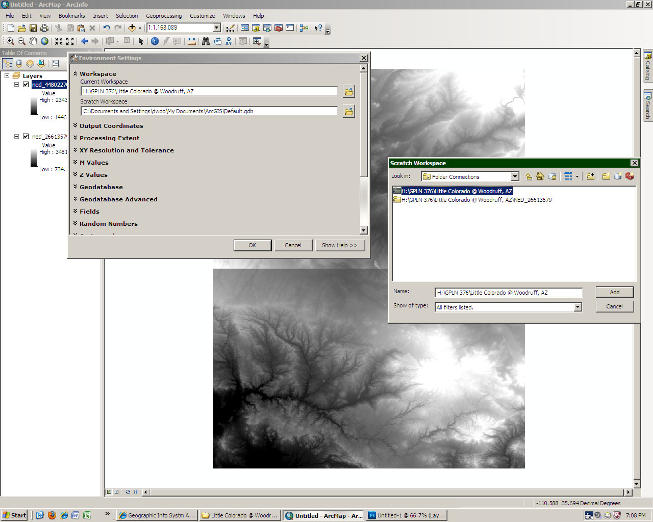
Next I set the environment and processing extent. (see below)
Geoprocessing>Environment
Next I megered the two DEM's
Arctoolbox>Data Mangement Tools>Raster>Raster Dataset>Moasic to New Raster


Next I reprojected the merged DEM.
Arctoolbox>Data Management Tools>Project and Transformation>Raster>Project Raster

Notice that the read out in the lower right is now meters in the picture...which was created by going to Insert>Add New Data Set

Next I created a hill shade using the reprojected DEM.
Arctoolbox>3D Analyst Tools>Raster Surface>Hill Shade

Now I created the below using the fill command.
Arctoolbox>Spatial Analyst Tools>Hydrology>Fill

Arctoolbox>Spatial Analyst Tools>Hydrology>Flowdirection

At this point I tried creating a Flow accumulation raster but I was unable too. Every time I tried using the tool it would run, run and run.... I also tried to trouble shooting.... by creating a smaller area and that didn't work either. So I thought of one more thing that I am going to try during class.... hopefully it works, unless anyone else knows something that I don't know.
No comments:
Post a Comment